
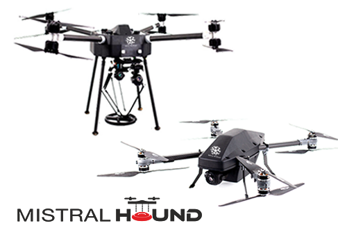
Mistral Hound
Mistral Hound is an unmanned airborne demining solution that uses a three-step process to map, detect and detonate land mines.
OVERVIEW
Mistral HOUNDTM is an advanced drone based mine detection and detonation solution for security agencies and special forces. The Mistral Hound is a combination of highly rugged drones for mapping, detection and detonation of landmines in a defined geographical area. The solution consists of a Mapping Drone and a Detection-cum-Detonation Drone. The drones are designed to survey and map the entire stretch of defined area, detect landmines, geotag their location on a 3D map, and finally neutralize them either by detonating from air or defusing manually.
The Mistral Hound consists of robust compact drones built with high-tensile carbon fibre to reduce weight and increase efficiency. Integrated with powerful coaxial rotors, the Mistral Hound is capable of long-range flights and can operate in full or semi-autonomous or manual modes.
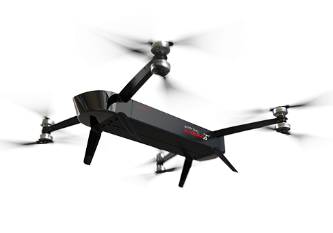
Mapping Drone
The Mistral Hound Mapping Drone is a rugged, long-range surveillance drone with a high-resolution multi-spectral camera integrated with a 3-axis gimbal to map a defined area. Operators can define the area to be surveyed using the cloud-based mapping software on the Ground Control Station (GCS). The drone creates an auto-path and flies over the defined area at a height of 100 meters capturing and streaming live video while mapping the area. The user can identify specific hazardous spots from the video streamed in real-time by the drone. The powerful zooming capabilities of the camera helps the user to analyse the area and mark the possible location of mines on a digital map. Once the drone returns, a 3D map of the surveyed area is generated using autonomous mapping functionalities, with all identified locations pinned. The map can also be used to further inspect the area using computer vision algorithms.
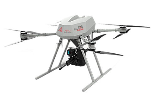
Detection and Detonation Drone
The Detection-cum-Detonation Drone is designed for the demining purpose. The drone comes with various mine detection sensors including a metal detector, ground-penetrating radar (GPR) and magnetometer. Operators can choose sensors based on the type of terrain being scanned and the type of land mines (landmines, UXOs and IEDs) expected there. The drone is equipped with a stabilization robot (to fasten the sensor) which has a swapping movement that allows the detector to scan the ground precisely. The data from the detection sensors are sent to GCS for geo-tagging the location of the mines. On completion, the detection sensor is replaced with a multi-functional gripping arm for detonation. Based on 3D maps created by the Mapping drone, the Detection and Detonation drone systematically scans the mapped area from a height of one meter, to detect and locate the mines. Depending on the data, the mines are detonated by dropping thermite sticks from a height of 60-70 meters. This ensures that deminers do not access the danger zones directly. They can instead remotely monitor the process using systematic scanning, identification and detonation offered by the Mistral Hound.
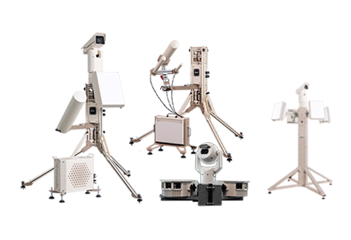
Ground Control Station
The Mistral Hound comes with a portable, single display GCS running the software and algorithms to control the drones, robot, and other accessories while mapping, detection and detonation. The GCS consists of a database of thousands of different types of mines for quick identification. The user can define GPS/RTK coordinates using the GCS, based on which the Mapping Drone generates a pattern to fly and map the area. The GCS allows the users to set the flight mode and view the data sent by the drone. The drone establishes a telemetry connection with GCS, through which users can monitor and adjust the routes in real-time.

Features
- Carbon fibre airframe
- Flight time: up to 60 minutes
- Operational range: 5 KM radius
- Mapping Altitude 100 meters
- Detection Altitude: 1 meter
- Detonation Altitude: 60 – 70 meters
- Mapping Drone Payload: up to 6 kg
- Detection Drone Payload: up to 30 kg
- Coaxial Rotors
- Flight modes - Autonomous, Semi-Autonomous, Manual
- Auto-path planning
- Flight / telemetry data recording
- Full HD 1080P, 60 FPS, 10x zoom mapping camera with 3 axis gimbals
- Fail Safe Alerts – Return To Home in case of link-loss and low battery
- Detection Payloads (Metal Detector, Magnetometer, Ground Penetrating Radar)
- Auto mapping and auto-detection of landmines with geotags on the map
- Operating temperature: -40 to 60 °C